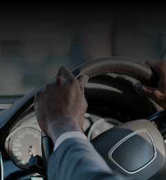
Microsoft has been developing its presence in the automotive sector for a number of years and working with several manufacturers on the software that helps the interface between driver and the increasingly sophisticated in-cabin telematics environment. Microsoft’s Greg Baribault explains the firm’s automotive sector presence and strategy
How did Microsoft start in the automotive industry?
Go deeper with GlobalData

Discover B2B Marketing That Performs
Combine business intelligence and editorial excellence to reach engaged professionals across 36 leading media platforms.
It was 13 years ago with Clarion on the aftermarket side with hands-free voice commands for entertainment systems like CD players. It was a great learning experience. The auto industry with its extremes of temperatures and harsh operating environment is very different from software in a computer and we learnt a lot. Then we worked with Fiat on their Blue&Me which was our first deep dive into auto manufacturing using Bluetooth technology. We took that and added some new parts and went to Ford for its Sync software which Ford has now extended and now we are working with Hyundai-Kia on Kia’s UVO technology which debuts in the US on the 2011 Sorento later this year.
That’s three mass market manufacturers you’re working with. What is Microsoft’s philosophy for its software within the auto industry?
Our goal is to take advanced software features and make them available to anyone, not just high end users. The Ford Focus sells in the US for $16,000 and comes with Sync as standard. People spend time at work and at home where they have computers and are connected. Until now, the car has been the island where they weren’t connected so we see it as a good business opportunity. Our Windows CE embedded software is already used in industrial automation such as robots, in hospital monitoring equipment and in hand-held tracking devices for warehouses, for example so it’s software that everyone could get. We’re being careful who we pick as partners.
How does the Windows software integrate into sat-nav systems?
We can break sat-nav into four components. The first is the navigation engine, the code or software that draws maps and calculates routes which is very technical application software. Second is the navigation data and information that’s collected by companies like Navteq and Tele Atlas. The third component is the software platform, Windows or Linux for example, that allows the first two to run and finally there’s the online services, real-time traffic information including accidents and map updates. The first component, the engine, is of less interest to us because each car maker has their own interests and designs and it would be very difficult to have one solution for all of them. Similarly, there’s no global solution for navigation technology. Roundabouts are almost non-existent in the US but common in Europe – navigation engines in the US do a terrible job of trying to route someone round a roundabout! Houses in Japan are numbered in the order in which they are built and not sequentially down the street. Examples like that are reasons we don’t build the engine but we can partner with engine builders.
So what are your main areas of interest?
We have an interest in map data. We’re waiting to see how Nokia’s purchase of Navteq, TomTom buying Tele Atlas and Google offering free mapping pans out, but we do need map data for local searches for points of interest for example. It’s also critical to have tools that allow car makers to connect cars to update data because it gets old so quickly. Updating data using a PC and USB drive which is then plugged into the car’s dashboard is one way forward. The days of DVD-based navigation systems are over. The other way will be to connect from the car to a cloud [computer infrastructure] to get map updates – that will be widespread in two to three years. Navigation by mobile phone is also coming where the phone display is shown on a screen in your car.
Does Microsoft have a role to play in the push for eco-driving?
Better navigation helps with more efficient driving, so that’s one way. But for electric vehicles navigation becomes critical, letting the driver know what range they have left and routing them to a recharge point or battery-swap station. It really changes the dynamics of navigation. Not only do we have to consider the fastest or shortest route but also the flattest routes to conserve battery charge or find downhill sections to help recharge batteries so a new option will be to have elevation changes.