To combat congestion and keep communities up to date with traffic dilemmas, Transport for West Midlands (a UK local government body) has partnered with navigation app, Waze.
Over the last few years, the area of the West Midlands in England has seen increased economic investment which in turn has resulted in more people driving to the region, attracted by the pull of modern infrastructure and new jobs. Although a positive for the area’s economy, this has led to an increased number of vehicles on the roads and added to pressures on public transport.

Discover B2B Marketing That Performs
Combine business intelligence and editorial excellence to reach engaged professionals across 36 leading media platforms.
In order to assist with this increased traffic flow and congestion issues, Transport for West Midlands (TfWM) has partnered with crowdsourced sat-nav app, Waze.
The partnership will allow TfWM to analyse data across the whole highway network, aiding the aims of lower road congestion, shorter journey times and increased road safety.
We spoke to Mark Corbin, director of network resilience at TfWM and Ru Roberts, UK country manager at Waze, to learn more about the benefits of the partnership and what goals are hoping to be achieved.

Just Auto (JA): Could you give me some background on your roles?
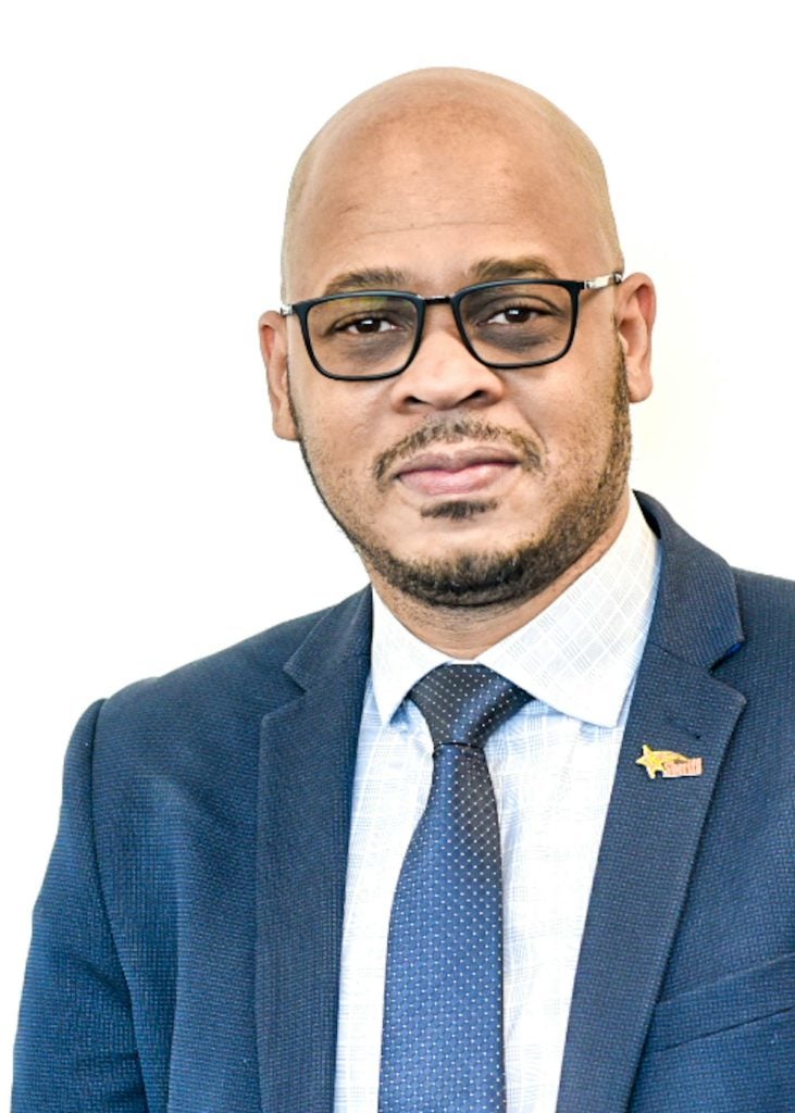
Mark Corbin (MC): I’m the director of network resilience at Transport for West Midlands (TfWM). Network resilience includes disruptions and the highway network, it also includes safety and security of people who are using transport services and some planning amongst other elements.
In terms of this particular space, we are looking at the whole area of disruptions and how we effectively communicate to people who are in the transport system, particularly on the road network, through a trusted source. That’s why this partnership is really important for us and why network resilience is of a key value to the partnership.
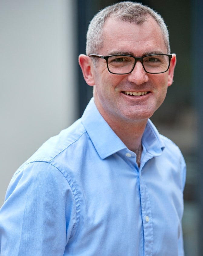
Ru Roberts (RR): I am the country manager in the UK for Waze; my remit essentially, is managing business operations in the UK, which includes our revenue model. Through advertising, it includes our marketing, communications, and any partnerships we have in the UK market, so it is inclusive of Transport for West Midlands, amongst others.

How did the partnership between TfWM and Waze come to be?
MC: You have to go all the way back to 2017. At first, we started to think about how were we going to manage disruptions in the region, and at that point ahead of us were things like Coventry City of Culture, the construction of HS2, the arrival of the Commonwealth Games (earlier this year). All of those things were ahead of us; we were really thinking: What do we need to effectively manage those huge events and activities across the region?
Part of that journey was establishing a ‘Regional Transport Coordination Centre’, which is a centre that sits here in Birmingham where we coordinate transport activity, seeking to keep our citizens and businesses moving, minimising disruption, acting as a trusted source of communication.
On that journey, we came across what became ‘Waze for Cities’. We felt really confident when looking at what the programme was intended to do, that there was a natural alliance there between what Waze wanted to do, and what we wanted to do as an organisation. So that’s where the partnership was initially struck up and we have been working together ever since.
RR: Waze for Cities collects lots of mobility data; anybody that’s using Waze is providing information on volumes of traffic and speed of traffic on any road in the network, across the whole country, and of course, in many other countries as well.
The provision of that information through, hopefully very easy to use dashboards, and that provision of data, allows partners like TfWM to ultimately make smarter decisions, when they need to.
I often like to think of Waze as the as the silent partner, because really what we’re doing is we are providing information. Only when there’s a major project would we maybe step up and take a bit more of an active role because it’s down to the proactivity of the partner to utilise the data for whatever project they’re doing. TfWM has proven to be that productive practice partner; it feels like a partnership that goes from strength to strength.
What are the key goals of the partnership?
MC: I would say having a trusted platform for communication, that’s key. I think we align in that space very well, that hasn’t changed. When people are in the transport system the one thing that they want to be able to understand and know is the information that they’re getting can be trusted, it’s reliable, and they can take decisions on it.
We haven’t shifted from that goal, that goal remains quite strong. We want to be in partnership because we both recognise the value of being and having trusted information as the source.
I think the second thing is all about the community and supporting people with their journeys. I think what underpins that for us is that we are still very much aligned when it comes to asking: “What do we want to do for our communities?” In this space, it is really helping people to make safe and efficient journeys on the road system, and then be able to understand what is going on.
I think from that perspective of being trusted, and being about community, those are two areas that remain top of mind in terms of what we want to achieve collectively.
RR: Waze’s founding principle was about eradicating traffic congestion; it’s about helping urban areas in particular to remove as much traffic as possible while facilitating journeys. That doesn’t necessarily mean removing the volume of cars because families have a high level of dependency on vehicles; especially since COVID cars have become the dominant vehicle choice for a lot of people.
Through the Waze for cities partnership, it’s about keeping our map as fresh with information as possible. That is alerts generated by users for things such as potholes, road traffic accidents, road closures that they visibly see and then alert others to in real time.
It’s also the two-way data share that we do have with partners, so TfWM providing us with lots of advanced information – whether it’s a big project, or a series of smaller projects that are going on in around the roads in the West Midlands, so our map is already taking all that into account when people take to the roads themselves. Our objective is clear, it’s about keeping traffic moving, and to do that better.
What are some of the key benefits of this partnership?
MC: For me, a key one is being credible. You absolutely have to be credible when you’re pushing information out to people. Waze has allowed us to have the ability to be in that space, communicating to people.
The second one, probably associated with that, is trusted. If people don’t trust what you’re saying to them, they’re not going to take any action. For us taking action is really important.
The third one is about how we ensure that we can manage major events and activities on our network in a way that is transparent. For me that is very important; the Commonwealth Games was a classic example. For all of road closures we were able to say: these are the impacts that likely will happen on the road network, these are the actions that we would love for you to take as a community.
It is how we bring those things collectively together to make sure that our residents, our communities, and the people who drive in the West Midlands have a clear understanding of what’s happening and what actions they need to take.
RR: From a user’s point of view the region of the West Midlands has some pretty major urban areas. For the UK, Birmingham in particular is the second biggest city in the country. Of course, it’s no surprise that it is a major car using city as well. From a company point of view, the partnership brings a relevance to users in the area to use Waze knowing that for, let’s say one in five drives, you are surprised and delighted by Waze.
Even on those commutes that you do day in, day out at least once a week, there could be an issue on the road that you wouldn’t have known about if you didn’t use Waze. You don’t want to miss that train, you don’t want to be late to work. These are stresses that people would naturally seek to avoid. The partnership makes Waze work better, they tell their friends, they tell their friends – the more people that use Waze, the richer the information, and that’s better for TfWM, so it becomes very self-supporting.
For me one of the major benefits is that we are always helping people on the road; this is also providing more information and more data so that TfWM can continue to make smarter decisions for the whole area, which positively impacts public transport and alternative modes of transport as well which in the end, fits into our objective of easing road traffic in urban areas.
Looking into the next few years what would you like to see the partnership achieve?
MC: Number one, the partnership is still going; we have learned a lot and we are much stronger. Further down the line I think that’s very important because given where we started from to where we are now and wanting to continue, this is a mature partnership.
I would want to be able to say this has helped us to understand specific locations on our network and how they behave at certain times of the day, and we have used that data to start to predict when the network is going to break down based on these type of activities that we know are happening. We can then run those models and we know exactly what’s going to happen and we are better prepared, because we have a historical understanding of key locations, and we can be ready and have a plan in readiness because data has told us this story.
RR: From our point of view there’s three things that we feel like we can make an impact on significantly at Waze.
Because we focus on roadways we have functionality that can send a user an alert for their arrival time. If they plan a journey, it will tell them when to leave; they will get where they want to go on time, which makes it a perfect partner for public transport as well.
I think that moving forward we can ask questions such as: Are there better ways that in an area such as the West Midlands, we can look at how our functionality can be better utilised to optimise for multi-modal transport?
Removing traffic or easing traffic is better for the economy, it gets people where they’re going quicker; it’s ultimately better for economic activity and investing – whether that’s through retail or local businesses in urban areas. They’re able to spend their money in those areas, which drives the economy, people get to work on time, so you’re not losing an hour’s worth of productivity. These are all good things for the local economy.
It’s better for the environment. We know that standstill traffic is worse for the environment than moving traffic even if you’ve got the same number of cars. It also helps reduce stress levels.
Now those three things are incredibly hard for us to be able to say: Waze was specifically involved in the impact or outcome.
In the future, if Mark and I can come together with a strong partnership and we’ve continued to share data and work on projects together and at the same time we can see that there’s cleaner air in the West Midlands because we supported clean air zones. Or if we can see that the local economy has fared well and we can see that it is moving in the right direction.
Of course, it’s very hard to measure individual stress levels, but if we can see movement on those things, we can safely say that we are at least contributing, and the partnership is part of a much broader experience for those that live and travelling around the West Midlands.


